Sunday, August 27 we arrived at Munising Tourist Park in the afternoon, using several sites on the western edge of the campground. I went for a swim in Lake Superior and found the water pretty comfortable, a result of being in the bay where the water is a little more shallow. After everyone in our group of six had arrived, we headed into Munising for dinner, and then had a fire before bed. While the campsites were nice, and some had views of Lake Superior, the road noise from M-28 made sleep difficult.
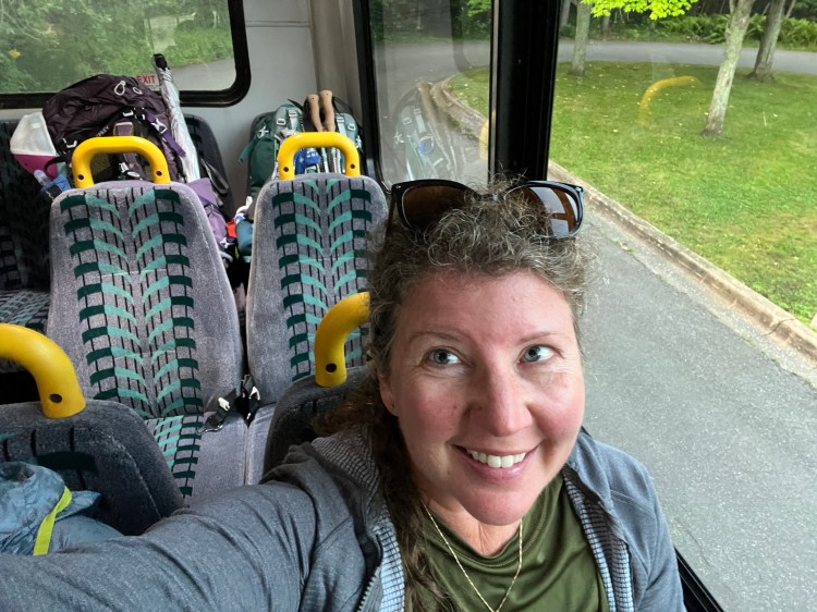
We packed up in the dark to meet our Altran shuttle at the Munising Falls Visitor Center, and by 8:00 were underway to Big Sable Visitor Center, where we would begin our 42-mile hike. The shuttle made several stops along the way, so the trip took about an hour.

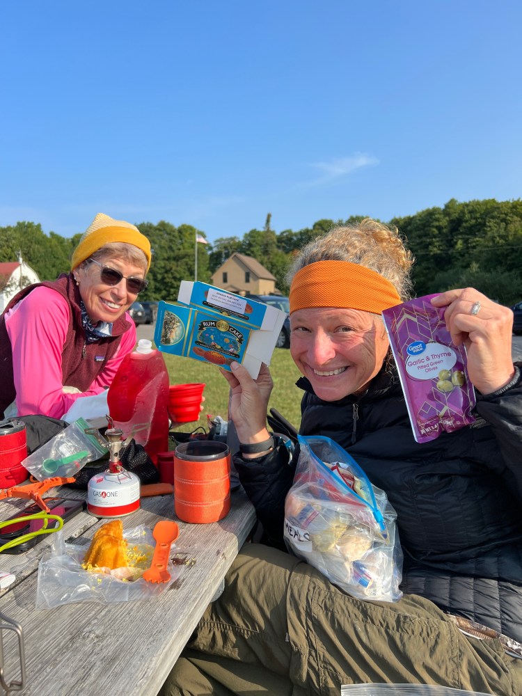
After cooking breakfast on the picnic table at the visitor center parking lot and getting a group photo, we took off on our hike. Our destination for the day was Au Sable East campground, about seven miles away. We were using backcountry campgrounds that my friend Doreen had reserved in advance (dispersed camping is not allowed at Pictured Rocks, so you need to use the National Park Service website to make reservations.)
It was a relatively easy hike to the Au Sable campground–while the NCT is not blue-blazed through the National Scenic Lakeshore, the trail is easy to follow, and was in good condition. When we arrived, we occupied our three reserved sites (which only allow two tents or hammocks and up to six people per site). Since our group was made up of six people camping in separate tents, three campsites were required. While we were setting up, a group of young men asked about building a fire in the metal fire ring that was near my campsite. They had been ticketed ($255) the night before in a different site for building a fire in an existing rock fire ring, not having read their permit carefully (fires are only allowed in the metal fire rings) so they wanted to be sure they were not only legal, but not going to be an annoyance to me and Jeannie, who were camped closest to the fire ring. We assured them we’d love to share a fire later, and promised to scavenge some deadfall while we were exploring.
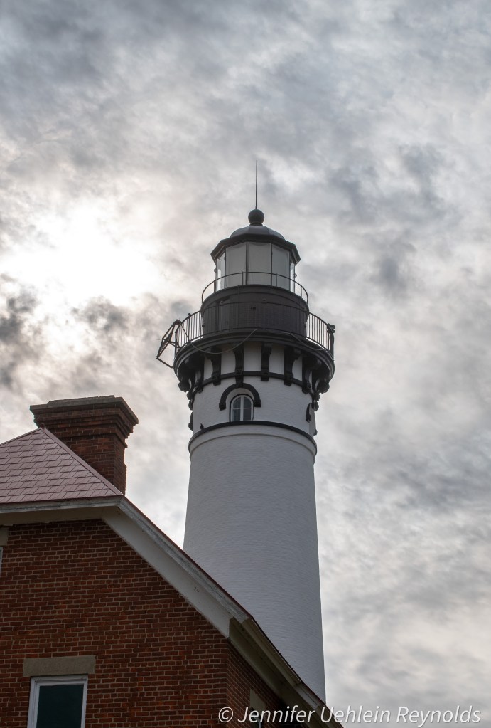
After a swim for me in Lake Superior, and a group hike to the Au Sable light station, we returned to the campsite to make dinner and discovered that a father/son duo who had been on the shuttle with us had also arrived. The father seemed a bit grumpy about the difficulty of the hike, which worried me a bit, since I knew what we had just completed was one of the easier sections.
We all enjoyed the fire that evening, and headed to bed content, although a bit wary of the rain in the forecast for overnight.
Sometime in the night, the rain indeed rolled in, along with thunder in the distance. My tent was pitched on high ground, and aside from some splashing that came in under my rainfly, I stayed dry and got a good night’s sleep. I heard the father and son pack up and leave while I was still luxuriating in my down cocoon. David reported waking to a puddle in his tent, a result of his and Doreen’s campsite being located in a depression where the rainwater pooled. We cooked breakfast in the drizzle, hoping for the weather to clear.
As we hiked past the light station again, the mist did begin to abate, and by the time we arrived at the Log Slide overlook, it had cleared completely and the sun came out. We pitched our chairs next to a display of old logging equipment and fielded questions from tourists about our gear while we ate lunch. One man asked to lift David’s pack, and shook his head as he lifted it a few inches off the ground. I think it only weighed somewhere between 30-35 lbs., but it still made an impression on the guy.
After lunch we explored some of the trails around the Log Slide area. There were many warning signs about avoiding going all the way down to the lake, because the trek back up is so steep and difficult. We stayed up top and explored for a little while before resuming our hike toward the Sevenmile Creek campground where we were staying for the night.

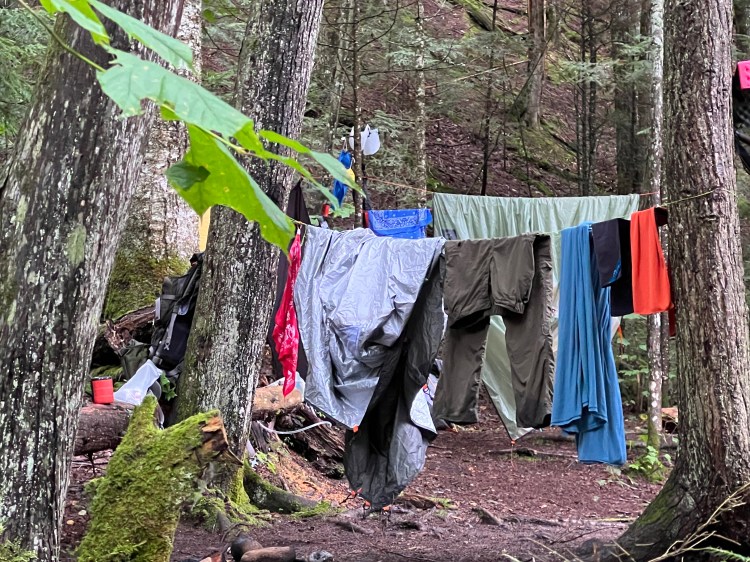
Upon arrival, we discovered the creek area to be darkly shaded by cedar and hemlock trees, with an air of enchantment about it. The heavy wind we could hear in the treetops was not present at ground level, so our damp gear had a slim chance of drying, even though we strung clotheslines from the trees and hung gear on tree branches. I took an hour or so to go exploring with my camera to give my tent a chance to air out before I pitched it.
This campsite also had a fire ring, so we collected wood, cooked dinner, and surprised ourselves by successfully keeping the fire going, even though everything we had found was pretty damp.
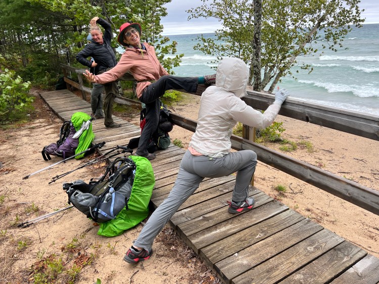
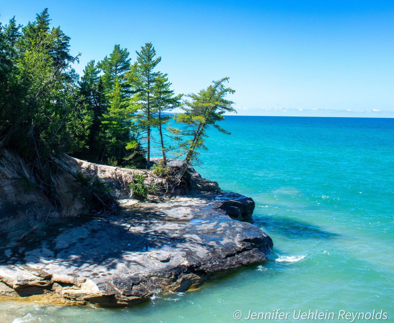
The following morning, we packed up our much drier tents, ate breakfast around the fire ring, and headed off toward our next destination, Chapel Beach. This stretch is where you leave the dune views and begin to get into the iconic rock formations the area is known for. We began to see tour boats along the shoreline, and could sometimes hear the narration of the tour. Every sidepath that headed towards the lake was a temptation, and because this was an 11-mile hike, we had to balance staying on trail with enjoying the views. This section of the hike also was a bit more difficult, with some steep climbs and big steps over rocks and roots. It was a beautiful sunny day, the wind kept any bugs at bay, and the water was a gorgeous turquoise blue. When we arrived at the Chapel campsites, we discovered that our sites were quite a distance from each other, so we made plans to meet at the lake view boardwalk to cook dinner. We discovered some piles of lumber for a new boardwalk that made excellent cooking platforms! After sunset, we went back to our tents for an early night.
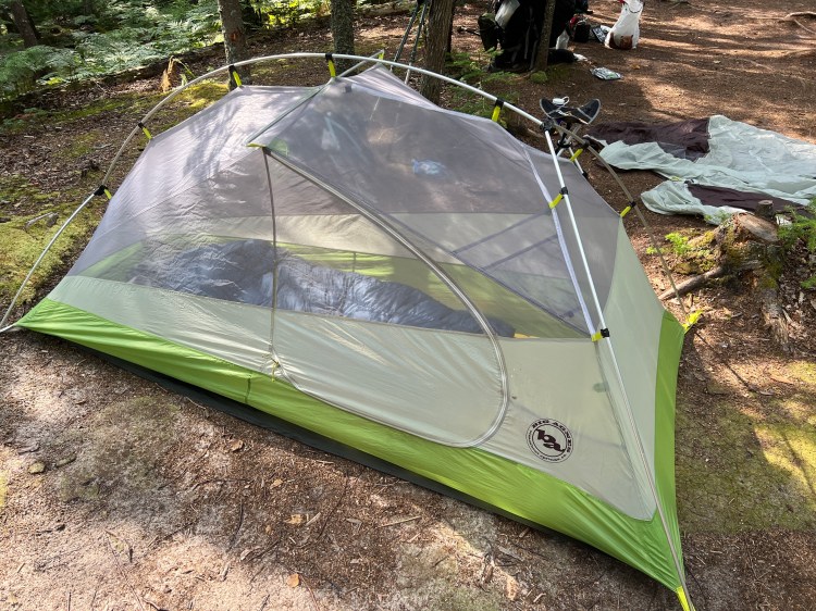
When I put up my tent at the Chapel campsite, I discovered I had a gear failure. I was using a Big Agnes Rattlesnake SR1 tent that I had bought from the REI used gear site about three years ago. When it had arrived, the plastic connector for the poles had a crack in it, but rather than return it, I had epoxied the crack, and it had held ever since. Until now. The connector was critical to providing the tension that gave the tent headroom. After messing around with it a bit on my own, and then consulting with David, we rigged up a system that employed my trekking poles to keep the tent up. The rainfly did not fit very well over this system, but there was no additional rain in the forecast, so I hoped for the best. It was a bit nerve wracking to have my shelter amiss on day two of a five day trip, though! (Now that I’m home, I’m hoping that I can get a replacement part from Big Agnes!)
The following morning, David and I were cooking breakfast at the lake overlook when a pontoon came around the point with a crew of six official looking people, all wearing orange life jackets. They pulled the pontoon up onto the beach, secured an anchor, and after taking off their life jackets, each shouldered several boards and began to hike up the steep slope of the dune. It seemed the boardwalk crew had arrived to continue their work. Luckily, they didn’t need the boards we were cooking on just yet! My fuel canister ran out just as I finished heating water for coffee and oatmeal, so it would be cold-soaked meals from here on out.
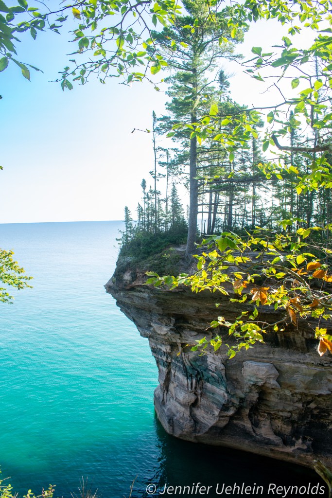
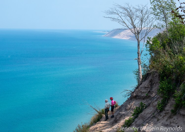
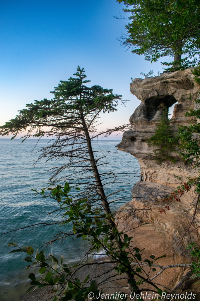
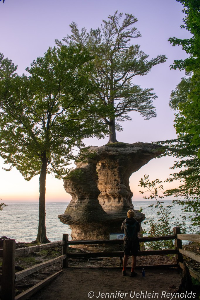
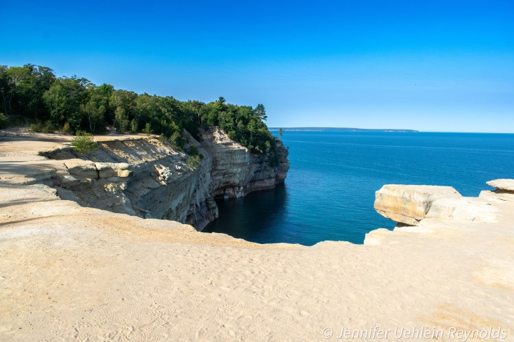
We began our hike toward the Cliffs campsite around 9:30, continuing to enjoy the incredible views of rock formations and Lake Superior’s incredible color. It was another 11 mile day, but the scenic view paths kept calling! One particular view was quite disconcerting: What looked like a wide beach was actually a dramatic drop off–what appeared to be sand was blond sandstone with fine gravel on top, and upon closer inspection, the water that appeared just beyond the “beach” was Lake Superior, a good fifty feet or more below. It was definitely one of those places where I had no desire to get terribly close to the edge.
Around 3:00 p.m., we had made it to the road walk that passed Miner’s Beach. We still had three more miles to hike, and I was tired. When some of the group decided to go down to the beach for a while, I opted to continue hiking toward the campsite, knowing that the sun exposure and heat on the beach would further sap my energy. I filtered water at Miner’s Creek, loading up since there was no water available at the Cliffs campsite. The hike involved a few big uphills, and then turned muddy. While there were some new boardwalks through the muddy areas, others had deteriorated to the point it was probably safer to walk in the mud than risk the board breaking underneath me. And then there were muddy areas with no boardwalk, but the mud was dry enough that it wasn’t much of an obstacle, and it was interesting to see the animal tracks preserved in it. Compared to my initial through-hike of Pictured Rocks in May of 2017, this mud was nothing.
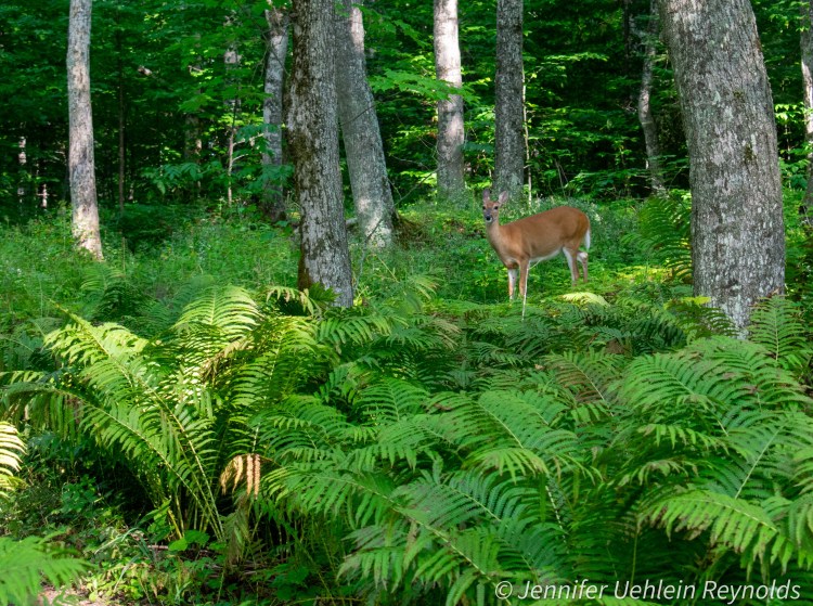
I came across the sign for the Cliffs campsite amongst a thicket of raspberry brambles and ferns, the path hidden by their foliage. As I made my way through, I startled three deer who were intent on holding their ground, so I waited a few minutes before moving forward, taking the opportunity to snap their picture. Eventually, they moseyed along and I made my way into the campground, which was in a clearing, and empty of other campers. I unpacked a little, adding water to my dehydrated chili supper so that it would have adequate time to soak before dinner time. I struggled to set up my damaged tent alone, accidentally losing the shock cord down the pole when I tried to improvise a fix. It took me a good 15 minutes to get my shock cord back through the tent pole and secured, but eventually I got the tent up, and began to collect firewood. I had about two hours to myself before my companions rejoined me. After they set up their tents, I lit the fire and we ate dinner. My cold-soaked chili wasn’t bad–the weather was warm enough that a hot meal wasn’t really necessary, although a few crushed corn chips would have been a welcome addition.
Later that night, after we went to bed, the wind kicked up and I wondered how my makeshift tent set up would hold if a rainstorm blew in. Luckily, I didn’t find out–it stayed dry all night, even as the wind whooshed through the treetops.
We opted for an early start on our last day, as some of us had long car trips home, so I was taking down my tent by the light of my headlamp at 6:30 a.m. Friday morning. Our last five miles to the Munising Falls Visitor Center were an easy hike, with a few small waterfalls down the cliff face along the way. We also took a quick walk to view Munising Falls. After changing into clean clothes, brushing my teeth, and splashing some water on my face in the public restroom, we headed to Foggy’s Bar for lunch, between Munising and Christmas, which I highly recommend, unless you’re in a hurry. We gorged ourselves on appetizers, perch, burgers, and some kind of bacon-wrapped steak, then headed home, ready for a shower and a real bed!
