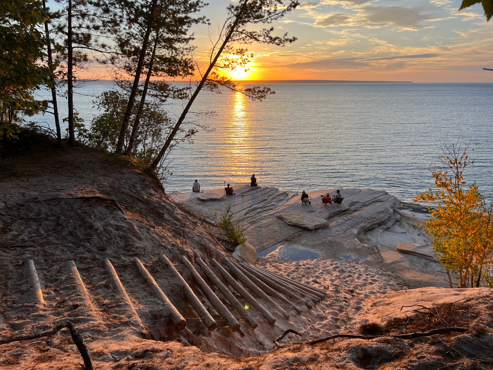
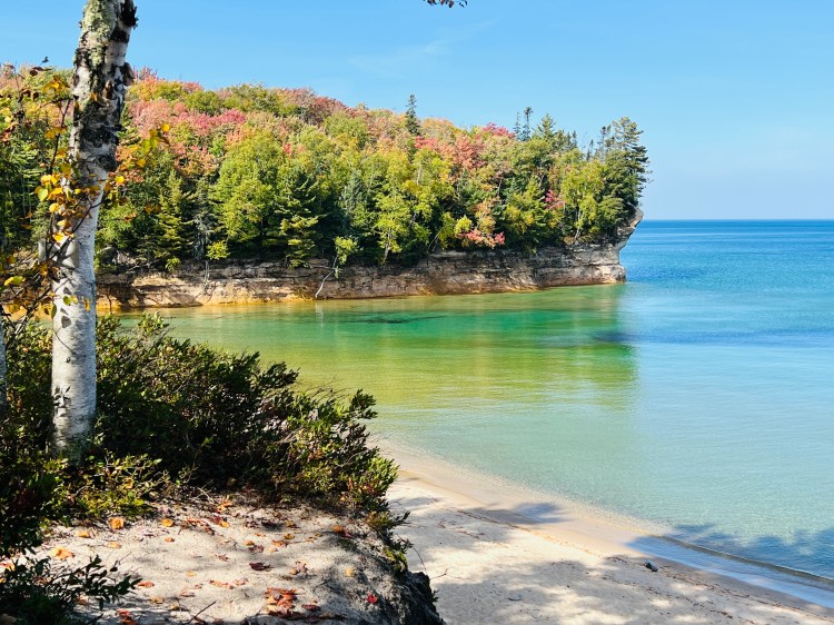
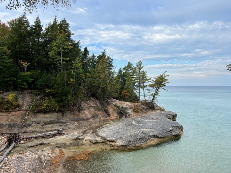
John Muir once said that he didn’t care for the word “hike,” but preferred “saunter,” with its origins of making a pilgrimage to the holy land. I think that many of us who hike consider nature a holy place, and regardless of your religious beliefs, the views at Pictured Rocks certainly make you pause and “contemplate the universe,” as the cooking instructions on a packet of Good to Go pasta marina instruct one to do while waiting for the meal to rehydrate. In the spirit of sauntering and contemplating the universe, I planned a drawn out trip of Pictured Rocks that lasted six days, covering the 42-mile hike at a more gentle pace than other backpackers might choose.
My first hike of Pictured Rocks was about five years ago, when I was just getting into backpacking. I went on a trip that another person had planned, and we hiked the stretch in late May. It was muddy, and most of the winter blow downs hadn’t been cleared out of the trail yet. It’s one thing to climb over a fallen tree trunk, but a pine tree with branches all the way down blocking the trail near a cliff is another story, so that added challenges to each day’s hike. But, there weren’t many people there, there were no mosquitoes or stable flies yet, and we had decent weather, so that was the upside of going so early. Our first day out of Munising was 16 miles, and we camped three nights in total, at Chapel, Mosquito Creek, and Masse Homestead. I was a new backpacker, carrying way too much stuff in my pack, and only using one trekking pole. I had a great time, but I’ve always wanted another chance to hike the park at a more leisurely pace, and with better gear.
Planning a trip at Pictured Rocks requires a lot of front-loaded work, because the campsites fill up quickly and dispersed camping is not allowed. There are multiple backcountry campsites throughout the park along the NCT, but they must be reserved in advance. The NPS website opens on January 1, and I was ready with my itinerary. The National Park service has a thorough page for backpackers that assists in trip planning. The mileage grid provided in their pdf seems to be about 10% short compared to GPS tracks I’ve taken, so be prepared for what’s listed as a 10-mile hike to be closer to 11 on your tracker. Sometimes it’s a little bit of a hike off of the NCT to arrive at the campsite, too. If you’re not up for backpacking in general, there are several traditional campgrounds accessible by car that offer loop trails throughout the area for day hiking.
There are individual backcountry campsites that allow up to six people and a maximum of two tents or hammocks, and group sites for 7-20 people, and up to 10 tents or campsites. The individual campsites require you to camp within 15 feet of the campsite post, and the group sites are a bit less defined, as there is no campsite post. Some campsites have a water source nearby, but not all, and some sites do not allow campfires. If you’re putting in big miles, or camping in the summer when it’s light out well past hiker midnight, you might not care about having a fire, but on our October hike, when it was dark by 7:30 p.m. it was nice to have a fire. Campsites that allow fires have a metal fire ring. You may spot rock fire rings that others have created, but if you are caught using one, it’s a $255 fine. (I met a group previously this summer that had gotten a ticket.)
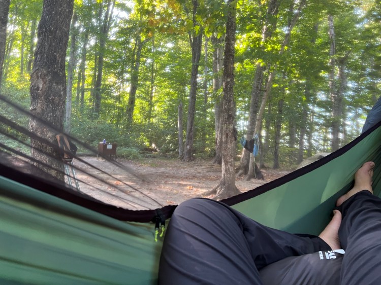
If you are a hammock camper like I am, using the individual sites can be next to impossible because of the “camp within 15-foot of the campsite post” rule, but the group sites were much more hammock-friendly. If you really want to hammock, I’d suggest finding 6 friends to go with you and reserving the group sites.
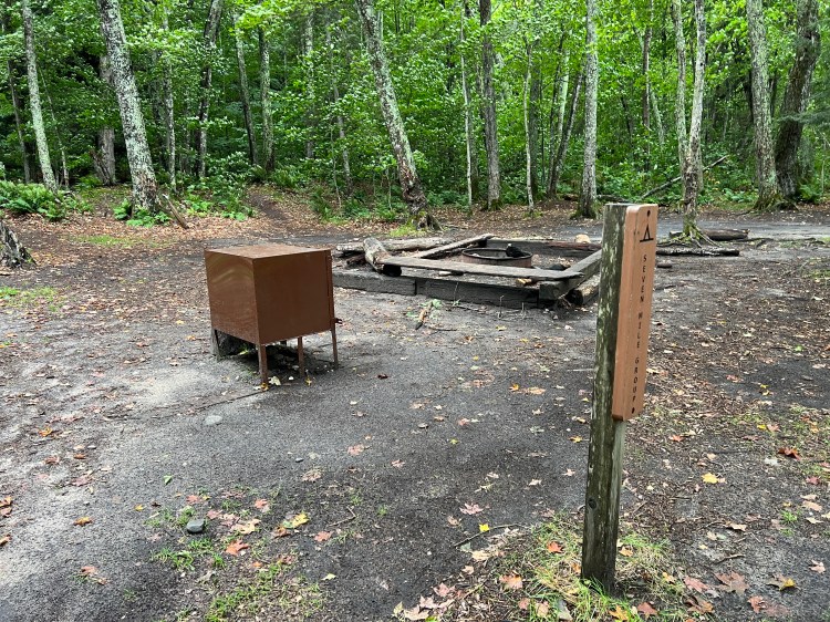
Most campsites have a privy, often a bit of a walk into the woods, which helps keep the smell at bay. Most are thrones in the woods, with no walls, or sometimes a V-shaped wall to provide some privacy from the path from the campground. We had to laugh at the privy at the Mosquito Creek group campground–it was right next to a loop trail from the parking lot/trailhead that goes to Mosquito Beach and Mosquito Falls. Several members of our group while sitting on the throne had confused hikers asking them for directions. Not exactly the privacy I’m looking for when nature calls! Also, all privvies are a “BYOTP” situation, so make sure you have plenty of your own toilet paper,
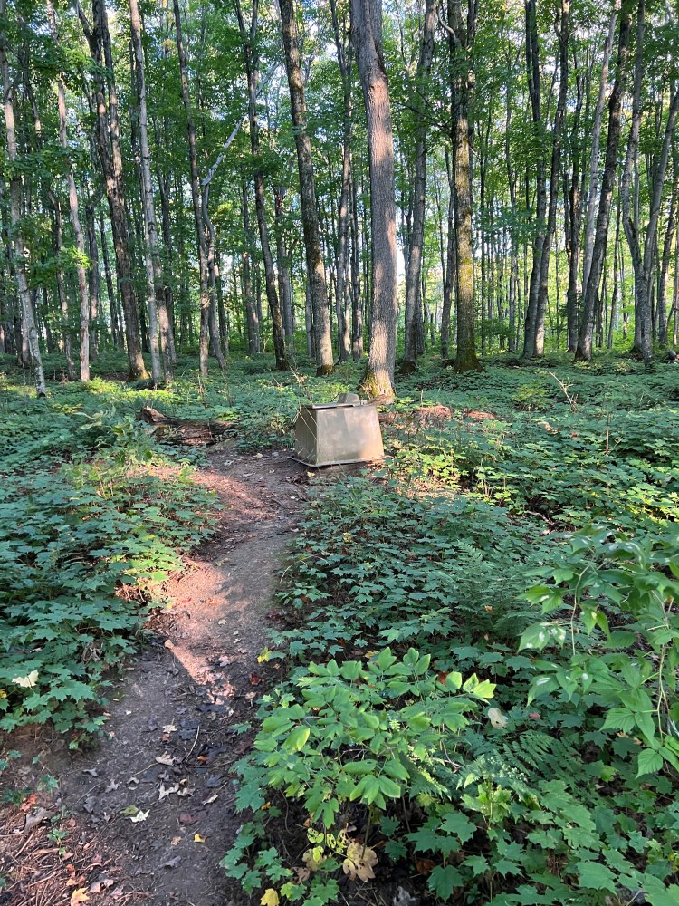
Each campsite has a bear box or pole (we only saw boxes on our trip) for keeping your food safe. While we saw zero signs of bear, I know that others have. The chipmunks and red squirrels were very bold in attempting to get to our food, and I was glad that I didn’t have to worry about them shimmying down my food bag line if I’d hung my food in a tree. Also, it’s really nice not to have to worry about hanging a bear bag when you get to camp–you toss your food in the bear box and you’re done!
In terms of navigation, you may think that none is necessary because you’re hiking the same direction the whole hike. However, there are a few roadwalks and places where scenic loop trails intersect, and I found the Avenza app to be helpful. Because this is a National Scenic Lakeshore, it is not blue-blazed the way most of the NCT is, which can be unexpected to those used to looking ahead to find the next blaze to verify they’re on the right path. There are some wooden signs at some trail junctures, but not all of them.
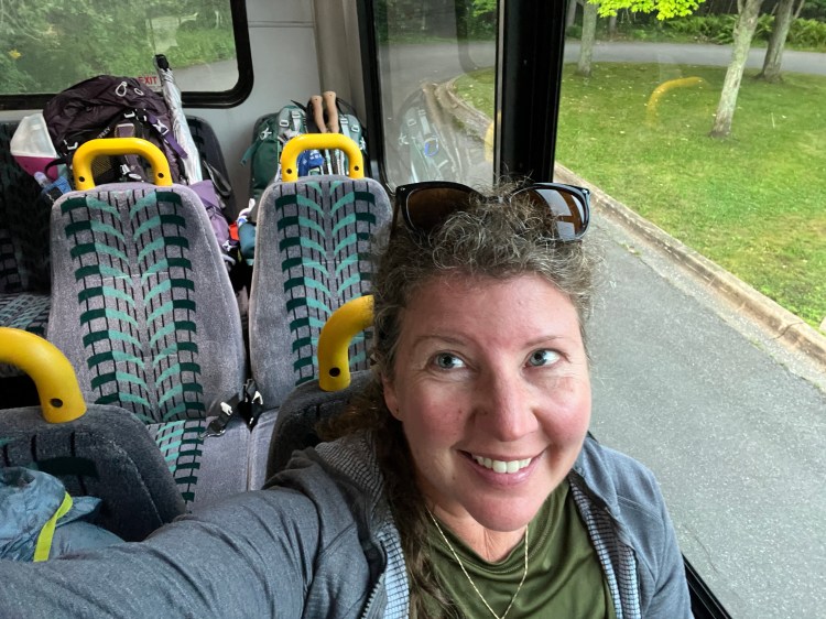
Using the AlTrain shuttle allowed us to avoid staging cars at the beginning and end. Our group met at the East Branch of the Fox River State Forest Campground the night before we began hiking. Located between Seney and Grand Marais, this was an easy meeting point. In the morning, we drove to the Grand Sable Visitor’s Center, and the shuttle picked us up and delivered us to Munising Falls Visitor’s Center to begin our hike. The shuttle ride can take anywhere from 30 minutes to an hour, depending on how many stops within the Pictured Rocks area have been requested. (Many hikers cut off the first and last sections, as they are not quite as scenic as the middle.) The shuttle costs $35 per hiker, as of Oct. 2023. You can make reservations here. Altran requires that you already have your backpacking permit, so take care of that first. Also, if you are trying to hike in late fall or ealy spring, Altran might not be running yet due to road conditions. While you might be tempted to just stage cars yourself if they’re not running, you might want to consider whether or not getting stuck in an area with limited cell service is a good idea. Some of the roads into Pictured Rocks are narrow dirt roads that are not plowed in winter. The roads to the two main visitor centers at either end are main roads, though.
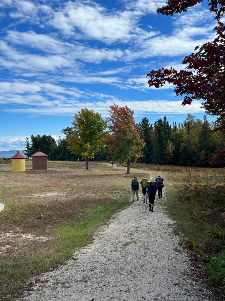
In planning our our daily mileage, I wanted to keep the first and last days short to allow for travel time, so after beginning in Munising, we had a five mile hike to Cliffs group camp site, seven miles to Mosquito Creek on day two, nine miles to Coves and Seven Mile Creek on days three and four, eleven miles to Masse Homestead on day five, and five miles to finish up to Grand Sable. (Mileage is rounded up if it was a decimal.) While this pace required taking more days off to complete the hike, I was glad to be able to soak up the beauty of this special place.
